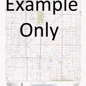
NSW 8635-N – Tenandra on Sale
- Estimated Delivery : Up to 4 business days
- Free Shipping & Returns : On all orders over $200
This Topographic Map is produced by the New South Wales Government.
This map is supplied in digital in PDF format, which means it can be printed at home or sent to a professional printer for a 100% scale reproduction.
At this scale, 2cm on this map represents 1km on the ground. A standard map (which is square) covers an area of approximately about 25km by 25km, with a contour interval of 10m. This map contains natural and constructed features including road and rail infrastructure, vegetation, hydrography, contours, localities and some administrative boundaries.
Calgary Cooba Goobel Moonambil Bretni Federal Park Hillside Wilgadeen Karoo Calga Narritagah North Luanna Anawa Woodbine Warrego Budgerie Calga West Square Mountain Elabang Uliwah Narritagah Blue Hills Doondi Wingidon Goorianawah Wonga Thurloo Mungeri Derra The Valley Milchomi Willow Downs Brolga Nyora Quanda Wilga Vale Narellan Yarranbee Parmedman Digilah Claremont Windemere Pleasant View Sunny Park Walla Walla Bouwick Wilga Downs Bramble The Summit Carlton Silent Dale South Walla Walla Gunnawarra Claraway Mount Bullaway West Guinema Mouragilla Mount Bullaway Penally Rosewood Northwood Kelvin Grove Barambah Mena Nebraska Magunyah Warrawong Bundah Oakwood Stornaway Gumin Wambelong Mount Aranon Aranon Pinnacle Baronne The Basin Black Mountain Black Hollow Black Gutter The Black Gutter Box Hill Box Ridge Branch Creek Mount Bregon Brigalow Brigenbah Creek Brigenbuh Creek Briglo Station Broken Dan Brownes Creek Buchanan Bulgan Creek Bullaway Bullaway Mountain Bullaway Mount Bullawi or Sally Springs Creek Calerini Basin Caleriwi Rock Hole Caleriwi Creek Calga Creek Calga Hill Carwell Chalkers Creek Chalkers Mountain Chalkers Ridge Colwells Gap Crusher Ellis Elongery Siphon Elongery Friend Goorialga Dam Goorianawa Goorianawa Gap Goorianawa Plain Green Hill Iron Pot Pinnacle Jeffs Mountain Left Branch of Calga Creek Right Branch of Calga Creek Mount Exmouth Frazers or Caleriwi Creek Goorianawa Valley Green Mountain Gurealga Dam The Iron Pot Jacks Dam Leslie Little Bullaway Loadstone Hill Looking Glass Creek Looking Glass Mountain Magometon Magometon Hill Magometon Mountain Magomodine Tank Main Camp Dam Middle Creek Milchomi Creek Mount Brecon Mount Tenandra Mount Tenandra Creek Mungery Mungery Creek Mungery Dam Mungery Tank Narratigah Dam Narratagah Dam Narratigah Oaky Creek Parmiduan Parmiduan Creek The Pulpit Quandra Quanda Quanda Quanda Quanda Creek Branch of Quanda Quanda Creek Quanda Creek The Rock Hole Round Hill Ryans Dam Salters Springs Salty Creek Salty Gap Salty Springs Creek Shore Sheep Dam The Siphon Springs Creek Square Top Hill Square Top Mount Stony Creek Tenandra Tenandra Creek Tenandra Hill Tenandra Mount Tenandra State Forest Tenandra Tank Ulomogo Dam Ulundry Wambelong Hill Wattle Spring Wattle Spring Creek White Tops Wingidgeon Gap Worinjerong Woringerong Creek Worinjerong Creek Yearanan Bulyawi or Salty Springs Creek Mount Donn Butterfly Butterfly Waterhole The Black Mountain Square Top Yarrigan Square Top Mountain Frazers Creek Bulyawi Creek Goorlanawa Gap Tenandra Mountain Gumin Gumin
| Title | Pdf Download |
|---|

